Follow us as we cycle our way throughout the USA. While our ultimate objective is to see this beautiful country of ours, we hope that these trips will also be the perfect trip for father-son bonding, getting in shape, learning new things, experiencing America, and raising money for Folds of Honor. We are definitely psyched for these epic adventures, and thanks for coming along for the ride!

Thursday, June 30, 2011

Day # 13: Jackson, La- Simmesport, LA. 63.5 Miles

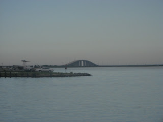
We left the B&B with 1/2 a loaf of banana- nut bread for breakfast. Luckily, we were back on the Adventure Cycling maps so we had a good sense of where to go (or so we thought). Later on down the road, we stopped to refill our water bottles and ate the delicious banana bread. As we continued towards St. Francisville (the end of Adventure Cycling map #6) we remembered that we were supposed to take a ferry across the Mississippi River (according to the map). We came to an intersection that didn't look right, so we asked someone which way the ferry was. He informed us that the ferry had been replaced by a new suspension bridge (see pics below). We double checked this information with receptionist at the Best Western Hotel across the street, and learned we had over shot the new bridge (so new that there weren't road signs designating it). We turned around (back up a huge hill) and eventually found our way onto the un- named road leading to the bridge. We stopped shortly after getting on the new road to drink some water. A man in a pickup truck pulled up next to us, got out of his truck, and started walking towards us with a big smile on his face. "Y'all biking cross country?" he asked. For the next 5 minutes we talked about how beautiful this area is for biking and about how nice the shoulders on the bridge were (he was getting us pretty excited to cross it). The bridge was incredible and we were the only ones on it (see pics below). The bridge, according to wikopedia is the longest cable stayed bridge in the western hemisphere, and the only bridge to cross the Mississippi for 90 miles. We biked through a maze of sugar farms (the roads were very John Denver- esk - see video below). Our maps indicated that there was a market/ place to eat (when we were about 14 miles away from Simmesport) but the GPS and the IPhone navigation showed no places to eat. We turned a corner on a quiet road to nowhere (see video below) and saw a sign for a restaurant/supermarket pointing over a huge hill (we later learned this hill was a levy to hold back the Mississippi river). We walked our bikes over it and found a small town with mobile homes raised up on huge pedestals (see pics below). We had a great lunch and met some nice people. They told us that the water a few weeks ago had been 30 feet deep where we had just eaten, due to flooding from the Mississippi River (crazy!). We left there around 2:00pm despite the rising temperatures. You know its hot when a local person says - its a real scorcher out here today (according to weather.com it felt like 105) We arrived at the Sportsman Motel (the only hotel for 50 miles in either direction) and checked in. We killed some bugs in our room and took nice cold showers before getting food at a market across the street. The motel is a bit sketchy and we will be sleeping with our mace next to our beds and getting out of here as early as possible.

Thanks for coming along for the ride!

Check out these 2 videos from our ride today:


Wednesday, June 29, 2011

More day #12 PART 2: Grillin' and chillin' and almost busted...

We decided to take a walk to the local supermarket to see if we could find some food for dinner (we had a microwave at our disposal so we had slightly more options. Walking by the meat section, something caught our eye... Kosher hot dogs!!!! My dad ran across the street to the Family Dollar to find a disposable grill and I picked up some buns, mustard, soda and chips. We got back to the B&B to cook our dinner. We decided to set up shop in the parking lot across the street (the ground was mostly gravel so we weren't very concerned about starting a forest fire). The coals caught quickly and flames were shooting up in the air.  We were grilling in no time! The only utensils we had were a fork and knife, but everything was working out really well. Suddenly, the Sheriff pulled up in his squad car. Our hearts skipped a beat as we feared he might confiscate the grill and hot dogs (this concerned me more than the thought of being arrested, my dad was worried more about being arrested). He asked what we were doing and we explained we were grilling hot dogs. He let out a big laugh as we offered him one (semi reluctantly) but he  said "No thanks, but you guys be careful and have yourselves a good night." And that we did. We grilled as the sunset on lovely Jackson, LA and enjoyed our hot dogs in the B&B with some Coke Zero while watching TV. 


Day #12: Amite, LA- Jackson, LA. 50.1 Miles

What up....
... HILLS... that's what!


We left the hotel in Amite around 7:00am with breakfast for the road. We enjoyed well paved roads and wide shoulders while biking on I- 55 North. We were shielded from the sun by the trees that lined the road which kept temperatures relatively cool. Then we turned onto route 10 West. Things were pretty different there... the shoulder stuck around for most of the ride, but we were biking with headwinds directly in front of us and the sun directly behind us.  In front of us were also  hill after hill after hill with little to no down hill. We knew the hills were coming, we just didn't know when. Today was the day.  Luckily we are in better shape today than we were a week ago.  On our way up one of the hills, we saw a dog standing up ahead on the shoulder we were using. Unsure if we should try to speed up (up the hill) or stop and use the pepper spray, we slowed down (not that we were going that fast). The dog saw how fierce we looked and bolted towards the side of the road...I guess we don't even need the pepper spray anymore (just kidding...I'm not letting anything happen to that pepper spray). We had found the only dog in the south that ran away from bikes rather than running after them.  We battled the hills until around 1:00pm when we stopped at a convenice store (they don't call them 'bodegas' down here) to fill up our water bottles. We ended up getting powerade AND boiled peanuts. We know the boiled peanuts grabbed your attention, so we will take a moment to describe why we decided to eat them. Everywhere we have been so far, we have seen big signs bragging about how they serve "the best boiled peanuts in the South!" We were  hungry when we stopped today, and  decided it was time to take part in this Southern tradition. These peanuts, slow- cooked in kosher salt and water, were perhaps the most flavorful (and healthy) snack we have ever had. They were better than regular roasted peanuts and had an edamamee like texture.  We strongly  suggest people try to make their own (or buy some...just try them!)!  We will be adding them to our cholent in the future.  The hills didn't disappear for the rest of the day, but the shoulder eventually did for some road work. We arrived in Jackson, LA around 1:40pm, and checked into the Old Centenary Inn (built in 1934 and protected by the National Historical Society). There is absolutely nothing in Jackson, LA but our friend Lynne would be happy to know that although there isn't a full service Tiffany's store here, they  have evidently opened a small satellite store that does haircuts (see picture below).


Thanks for coming along for the ride!

Check out our route at the link below: Amite to Jackson, LA


Tuesday, June 28, 2011

Day #11: Covington, LA- Amite City, LA. 43.0 Miles

We left the hotel in Covington at 7:10am with 3 bagels, 2 bananas, and 2 yogurts packed for breakfast. We took so much food because we realized we didn't eat much dinner last night due to the late/ heavy lunch we ate, and we were feeling low on energy. We biked on US- 190 for a few miles (no shoulder and lots of angry morning drivers= fun) but then it seemed that all traffic disappeared and we were in the middle of nowhere. We biked on the open road and passed very few cars. As we rolled through the farm country of LA, we passed cows taking refuge under big trees from the morning heat. In addition to the breathtaking scenery, we encountered non-stop rolling hills until we reached Amite. Amite is "small town USA" with a main street running right through the middle.  The people all seem friendly but religious diversification and tolerance don't seem to be high on their list (see picture below)  We arrived at the Comfort Inn in Amite exhausted and sweaty around 2:00pm. We had planned to sleep here because it is North/ West of Covington, and brings us much closer to meeting up with the Adventure Cycling maps. Our goal for tomorrow is to make it back onto the trail.  Overall the day was fairly uneventful but we were definitely happy to be on a scenic road (one of the goals of the trip is to see America after all) with few cars and dogs that only chased us to the edge of the lawn (there were only 2-3 dogs total today). We planned on going swimming, but a lightning storm struck just as we went outside. We decided to run across the street to the WalMart to get some stuff for dinner, and we made it there just as it began to pour. We waited out the storm while we walked around the store looking for various groceries that we could enjoy while watching today's movie  - Hunt for Red October. We enjoyed the movie a lot and suggest it to anyone who likes war/ suspense/ drama movies.


Thanks for coming along for the ride!


Check out our route at the link below: Covington to Amite, LA


Monday, June 27, 2011

Day #10: Diamondhead, MS- Covington, LA. 53.3 Miles

It was the best of times, it was the worst of times...


Actually, it was in reverse order. We left the hotel at 7:00am with heavily buttered english muffins and bananas packed for breakfast. While I-10 was a joyride yesterday, today was a different story. For a few miles we enjoyed the same shoulders as yesterday, but then in an instant, they were gone. Stranded on a huge bridge over the Pearl State Wildlife Management Area, we were forced to walk our bikes along the guard rail with huge trucks too close for comfort. On a positive note, the view was spectacular. After walking across the bridge, we saw signs indicating that we had in fact crossed into Louisiana!! State #4... what up!! After taking a picture (see below), we saw a sign for a tourist  center just 2 miles down the road. On our way, we passed a small forest fire (see pictures below) and encountered 2 more shoulder-less bridges (they weren't nearly as long as the 1st one though). Tired and hungry, we arrived at the tourist center that had a rest area specifically for pets. We filled up our waters and devoured our breakfast. The woman behind the counter approached us (unsolicited) and asked if we would like some help figuring out the best way for us to get where we wanted to go. She showed us 3 maps which she had photocopied specifically for us and patiently explained how to get to a designated bike trail which would take us directly to Covington, LA (our intended destination). Instead of needing to get back on a busy road, the woman had a police officer open a back gate (which is only allowed to be opened in emergencies) which led us out onto a quiet road and eventually led to a long bike trail - see a small portion in video below.  We thanked her profusely and continued on our way. While things have been going well, we knew before we started the trip that we would need to rely on the kindness of strangers and the help of the Lord - today we had both. On our way to the bike trail, we were concerned that we had made a wrong turn, so we hailed down a man driving a tractor to ask for directions (see picture below). He not only stopped, but he got out of his tractor to point us in the right direction. The bike trail was beautiful and shady with frequent Ranger stations to fill up our water bottles with cold water. We stopped at these stations a few times and picked up some cycling maps for the state of LA (these came in handy when planing our route for tomorrow). We ate lunch at a a cafe along the bike trail and biked leisurely towards the Comfort Inn in Covington, LA. Out of the corner of his eye, my dad spotted a Wal- Mart (as only he could...the sign wasn't even that big) so we stopped in for a few things. We checked into the hotel and relaxed in the room. No movie tonight...just taking it easy and figuring out how/ when we are going to meet up with the Adventure Cycling maps (the ones we have been using).


Thanks for coming along for the ride!


Check out our route at the link below: Dimondhea, MS to Covington, LA

Check out a video of the bike trail we were on at the link below:
http://www.youtube.com/user/Elliotsloyer#p/a/u/0/JZZwQtAtca4


Sunday, June 26, 2011

Day #9: Moss Point, MS- Diamondhead, MS 53.2 Miles

This morning we pulled out of our hotel by 7:00am. We found that this helped us get another hour of biking in before the heat really sunk in. We continued on our homemade route which took us on I- 10. Last night we called the Sheriffs  office in Moss Point MS to find out whether bike riders were allowed on I-10 in the state of Mississippi.  Although everybody we have run into here could not have been nicer, we think we have seen movies (or maybe just had nightmares) about when people like us get "pulled over" in Mississippi.  The friendly police officer on the phone said it was not a problem.  There is a very wide shoulder (almost wider than the driving lanes) on I-10 which seemed to be the nicest road possible (flat, well paved, and with little debris). Unfortunately, this was true for only the first 2 miles.  After that, there was a stretch of the bumpiest and most cluttered shoulder (still just as wide though) we had ever experienced. I would compare it to the experience of riding on an old wooden roller coaster while sitting on a fairly hard/ narrow seat (yummy right?).   Just as we were beginning to lose faith in our new route, we saw a ray of light from the heavens, the clouds parted (there weren't actually clouds....we were baking in the full strength of the sun), and we heard faint music surrounding us (turns out it was my dad's iPhone). The treacherous roads suddenly gave way to the most beautiful, smooth stretch of road that we could have asked for. We flew down the interstate with new enthusiasm and speed (we think the trucks created some sort of tail wind because it felt a lot easier to be going faster than we usually go). We stopped for breakfast after 30 (seemingly quick) miles. Back on the road, the temperatures had spiked again so we stopped frequently for water breaks. One of these breaks took place next to, in our opinion, the best named rivers. The name of the river is Tchoutacabouffa (see picture below... remember that the next time you're playing 'hangman'). Around 2:00pm we arrived in Diamondhead, MS and ate lunch. We decided to call it a day, and we checked into the Econo Lodge just .4 miles away from where we ate. We changed into our bathing suits and swam/ relaxed by the pool for a while before eating dinner. While we ate, we watched The Big Lebowski (a classic comedy about an unemployed bowler who gets in over his head when he is mistaken for a millionaire with the same last name). Overall it was a funny movie and we recommend it!  Saturday night we watched the movie Bananas with Woody Allen which was so funny my dad was still randomly laughing about it today.  We're hopefully going to call it an early night so we can have another amazing day tomorrow!


Thanks for coming along for the ride!

Check out our route at the link below:
http://maps.google.com/maps?saddr=Amoco+Dr,+Moss+Point,+Jackson,+Mississippi+39563&daddr=441+Yacht+Club+Drive,+Diamondhead,+MS&hl=en&ll=30.387092,-89.060669&spn=1.042473,2.320862&sll=30.403675,-88.953552&sspn=0.521151,1.160431&geocode=FQRv0AEdKia5-ikNtbrp2uubiDGdsvcy0lJtEw%3BFe9mzwEdkDes-imrG-7J6zKciDEOh2TIefH2ew&mra=pd&z=9


Friday, June 24, 2011

Day# 8: Dauphin Island, AL- Moss Point, MS 41.2 Miles

We resolved yesterday's issue of no hotels or motels on our map (only camping)  for close to 200 miles(but at a small cost...more on that later).


We had a pretty late start today (8:00- ish) and we knew it was a mistake when we stepped out of our hotel into the heat. While it was slightly cooler than it has been in the past few days, we realized that the extra 30 minutes to an hour makes all the difference in terms of the temperature. We biked 1/2 a mile down the road to pick up some cinnamon buns and danishes for breakfast (to be eaten later). We continued on our way towards the bridge to get to the other side of Mobil Bay. Upon reaching the bridge, we came face to face with a 8%- 10% grade arch over the bay (picture of the bridge below, and video of my dad huffing and puffing and giving his rendition of the Little Blue Engine also below). We fought our way up and were thrilled when the next few miles after the downward side of the bridge were completely flat. We stopped in a nice gas station to fill our waters and found that along with the popular beef jerky and other preserved animal products, they carried pickled pigs- feet (yes, real feet in a jar). Unfortunately we didn't get a picture of this, but it was pretty gross and we decided no one would want to see that anyway. We stopped for lunch in Grand Bay, AL and continued on our way at 2:00pm. This is where our "genius" plan came into effect. Last night (after blogging) we realized that the maps had us avoiding highway US- 90 (which we have been following for most of the trip) by cutting North- West. We decided that if we followed US- 90 from Grand Bay Alabama (the map had us going there anyway), we would hit a nice strip of hotels. About an hour after we left Grand Bay, we did it again! Yes, that's right, the Sloyer men had crossed another border...this time into Mississippi, the 'Birthplace of America's Music' (according to the welcome sign... see below) We stopped a few miles down the road from the Welcome to Mississippi sign to figure out which hotel we wanted to stay at. Upon asking the shop keeper for the easiest directions, we encountered perhaps the strongest Southern accent we have ever heard (it was almost impossible to understand every word he was saying). He was also one of the friendliest people around. We sat on the picnic bench outside of the store for a little while, and we soon learned the slurred/ mumbled speech was not unique to the shop keeper. A handful of people stopped to ask us about our trip before entering the store, and each time my dad and I had to ask them to repeat a word or two. We got on our way and headed towards the Best Western Hotel in Moss Point, MS where we are going to spend Shabbat.  We would have taken a picture of the Welcome to Moss Point sign but half of it had bullet holes through it (which would have been a cool picture) and there was also a dog barking at us from the driveway next to the sign.  

Everything is working out so far regarding our improvising and leaving the mapped route (we still need to get back onto the map eventually (in the next few days probably). However, we now know why the maps had us avoiding US- 90. The roads were pretty bumpy, covered in glass and nails and other debris, and the shoulders had deep grooves to warn drivers that are drifting off the road - not a lot of fun for parts of your anatomy while riding over those groves for a few miles. We picked up some food from a small convenience store for Shabbat and we are settling into the Best Western in Moss Point, MS.

BIG SHOUT OUT: To our cousin Adina Falk!! Mazel Tov to you and your entire family on your Bat- Mitzvah!! We love you a a lot and we are so sorry that we're missing it. Good luck tomorrow :)

Thanks for coming along for the ride!

Check out our route at the link below:Dauphin Island, AL- Moss Point, MS


Check out a video of some of our route at the link below:
http://www.youtube.com/user/Elliotsloyer#p/a/u/0/Z-u-wFO0kbk